


Καλλιπευκη
Καλλιπεύκη
Η Καλλιπευκη βρίσκεται στον Κάτω Όλυμπο και στα Β.Α. του Ν. Λάρισας. Είναι κτισμένη σε υψόμετρο 1.100 μ. και περιτριγυρίζεται από πυκνά δάση οξιάς, βελανιδιάς, έλατου και πεύκου. Στα ωραία πευκοδάση οφείλεται και το όνομά της. Ανήκει στο Δήμο Γόννων. Μέχρι το 1911 το χωριό καθρεφτίζονταν στα νερά της λίμνης Ασκυρίδoς. Τη χρονιά αυτή αποξηράνθηκε η λίμνη και έδωσε για καλλιέργεια 5.000 στρέμματα γης.
Την τελευταία δεκαετία συζητείται έντονα η επαναλειτουργία της λίμνης για λόγους οικολογικής ισορροπίας, περιβάλλοντος και τουριστικής ανάπτυξης του Κάτω Ολύμπου. Από αρχαιοτάτων χρόνων η Καλλιπεύκη αποτελούσε πέρασμα από τη Μακεδονία προς τη Θεσσαλία. Από εδώ ο Ξέρξης πέρασε τα πολυάριθμα στρατεύματά του (480 π.Χ.) και ο ρωμαϊκός στρατός (169 π.Χ. Μάρκιος Φίλιππος). Επί τουρκοκρατίας είχε περίπου έξι χιλιάδες κατοίκους και ήταν έδρα επισκόπου.
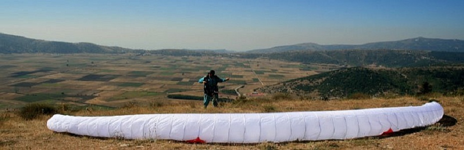
Οι επισκέπτες που θα έρθουν στην Καλλιπεύκη, θα βρεθούν μπροστά σε ένα θαυμάσιο τοπίο. Το δάσος της αποτελεί τεράστιο πάρκο με μονοπάτια, δασικούς δρόμους, γάργαρα νερά και διάσπαρτα εξωκλήσια στις πλαγιές και στα ξέφωτα. Χώροι αναψυχής όπως η Αγία Τριάδα και η Πατωμένη (αναψυκτήριο) θα ευχαριστήσουν κάθε επισκέπτη.
Γήπεδα ποδοσφαίρου και μπάσκετ και τρεις παιδικές χαρές θα ικανοποιήσουν τις ανάγκες των παιδιών και των νέων.
Στην πλακόστρωτη πλατεία του χωριού και κάτω από τα πλατάνια μπορεί ο καθένας να απολαύσει καφέ, τσίπουρο και φαγητό και να θαυμάσει την πετρόκτιστη εκκλησία του Αγίου Θεοδώρου. Από το 1996 λειτουργεί στην Καλλιπεύκη και η κατασκήνωση ΕΛΕΥΘΕΡΙΑ των προσκόπων Λάρισας και ετοιμάζει τη δική της και η Μητρόπολη.
Kallipefki
Kallipefki is located on the west side of the lower Mt. Olympus in the prefecture of Larisa. It is at an elevation of 1054 meters (3600 feet), and its surrounded by thick forests of pine, beech, oak, fir and spruce trees to the west, north and east and to the south by the plateau of the former lakebed of Askirida. The lake was drained in 1911 to make way for farmland of about 5000 stremata (1 strema=1000 sq. meters) (about 1235 acres) that was distributed to the local population.
The name of the village is derived from the words of good (kali) and pine (pefki) – “kalipefki”. It is said in that in ancient times Kalipefki was the passageway from the Macedonia to the Thessalia region. It is through this passage that the army of the Persian king Xerxes in 480 b.c. and the roman army of Markios Filippos in 169 b.c. crossed into the region of Thessalia (Greece). During the turkish occupation of Greece the town had about 6000 inhabitants.
Today’s visitor to Kallipefki will be greeted with breathtaking views of the surrounding green pine forests, the former lakebed plateau and the view of some of the legendary peaks of Mt. Olympus. The visitor will be able to follow the many local paths and the national path (marked O2), drink the crystal icy mountain waters from the various springs and visit the many small old churches on the hilltops around Kallipefki. One can follow the national path (O2) to the nearby village of Karιa and to the tallest point of Mt. Olympus «mitikas».
At the location «Patomeni» (about 500m from the village) there is picnicking facilities with running water, barbecue areas and tables while farther down (‘karavida’) there is open space for «free» camping. Since 1996 the organized campgrounds «eleytheria» (near karavida) have been used by various cub-scout organizations from Greece and around the world for their meetings. There is also a playground for kids and a full basketball court available for everyone’s use. At the village center square «platia» one can enjoy a cup of coffee or the tastes of local mezethes (appetizers) with tsipouro or a full meal under the shade of the platan trees.
Kallipefki is located only 24 kilometers (about 30 minutes by car) from the beautiful beaches of the popular summer spots of Platamonas and Agios Panteleimonas and about the same distance from the national highway Larisa – Thessaloniki at the exit by the Tempi tolls. It is located 23 kilometers from the town of Gonni (at the base of the west side of Mt. Olympus, beginning of the ascent to Kalipefki), 58 kilometers from the city of Larisa and 130 kilometers from city of Thessaloniki.
Kallipefki
Situee dans le Bas Olympe, a 1100 d’ altitude, dans le nord-est de la region de Larissa, au departement de Gonni, Kallipefki est entouree de bois de pins, de sapins, de hetres et de chenes. Elle doit d’ ailleurs son nom a ses beaux bois de pins (kalos= beau, pefko= pin). Jusqu’ en 1911 le village se mirait aux eaux du lac Askyris, qui a ensuite ete desseche pour donner a l’ agriculture 5000 hectares de terre propre a cultiver. Les dix dernieres annees on pense au refonctionnement du lac pour des raisons d’ equilibre ecologique ainsi que pour le developpement touristique de la region. Pendant l’ antiquite Kallipefki constituait un passage de la Macedoine vers la Thessalie. Par la Xerxis est passe avec son armee (480 av. J.C.) et plus tard l’ armee romaine marchand vers la Macedoine. Pendant l’ occupation turque Kallipefki avait six mille habitants et etait le siege de l’ eveque. Les visiteurs qui viendront a Kallipefki auront l’ occasion d’ admirer son paysage, de se promener dans ses bois avec les ruisseaux limpides, de visiter ses nombreuses petites eglises pittoresques. Des lieux de delassement tels Agia Triada et Patomeni, reposeront le visiteur. Des terrains de football et de basketball ainsi que trois jardins d’ enfants satisfairont les jeunes et les enfants. Dans la place du village, sous l’ ombre des grands platanes, les visiteurs pourront boire leur café ou leur ouzo et manger en admirant l’ eglise de Agios Theodoros. Depuis 1996 existe a Kallipefki un campement des scouts de Larissa. (Απόδοση: Καρδάκου Μαρίνα).
Kallipefki
Kallipefki liegt auf die 1100m Hoehe u.d.M., im Unteren Olymp, Nord-Oestlich der Larrissa-Perfektur. Das Dorf ist von dichten Buchen-, Eichen-, Tannen- und Fichtenwaelder umgeben. Von diesen Fichtenwaelder hat sein Namen bekommen. Bis zum 1911 spiegelte sich das Dorf an die Waesser eines Sees- Askyrida ist im diesen Jahr ausgetrocknet worden, und seine Flaechen sind zur Entwicklung der Landwirtschaft weiter gegeben worden. Die letzte zehn Jahre kommt die Wiederfuktion der Askyrida immer wieder im Gespraech, aufgrund der Oekologischen – und Umweltbalancebeduerfnisse und nattuerlich der touristischen Entwicklung der ganzen Gegend, die den Berg Olymp umgibt. Sein Wald ist eine riesige Naturpark, mit Fusswegen, Holzwegwen, klare Waesser, kleine Kirchen und vielen Freieplaetzen zur Erholung und Moeglichkeiten zum Sporttreiben. In Kallipefki kann jeder besucher am Platz unter den Platanenbaeumen einen Kaffe, ein Ouzo oder leckeres Essen geniessen, wobei gleichzeitig die Kirche von St. Theodor bewundern kann. (Απόδοση: Μάνια Χρύσα).


